Introducing our interactive mapping solution, where people, locations, and data seamlessly connect. Experience the power of smart, data-driven styles and intuitive analysis tools. Discover a new level of efficiency and insights as you work with our interactive maps.
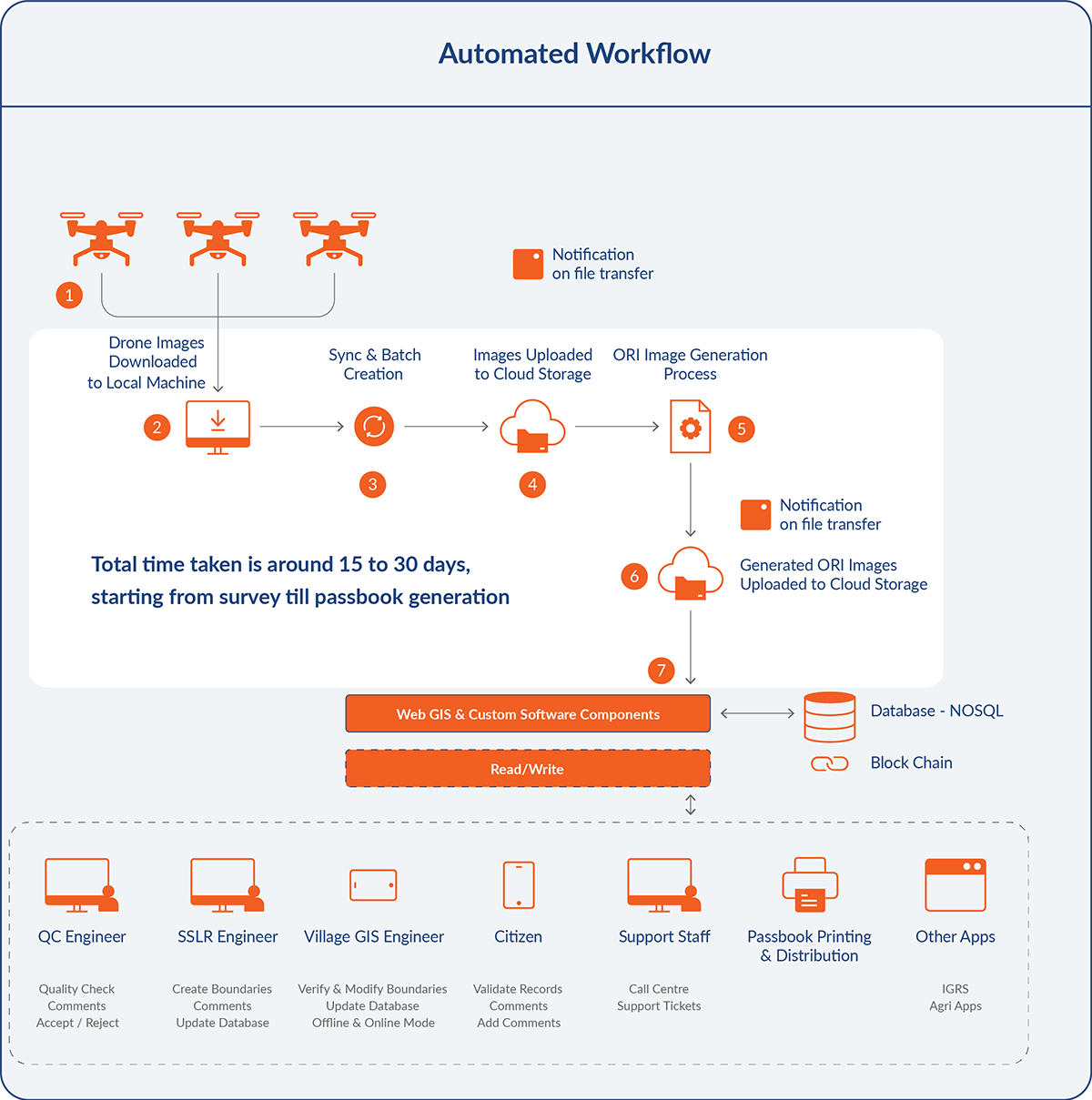
Navigating The GIS Solution: An Interactive Flowchart of Events
Fly, Transmit, and Analyze with Automated Drone Image Transfer
Elevate Accuracy with Automated Orthomosaic Image Generation
Streamlined Notifications and Quality Control Workflow at Your Fingertips
Embrace the Power of the Cloud for Seamless Integration
Seamlessly Create and Manage Land Parcels
Unleash Insights through Advanced Reporting and Passbook Generation
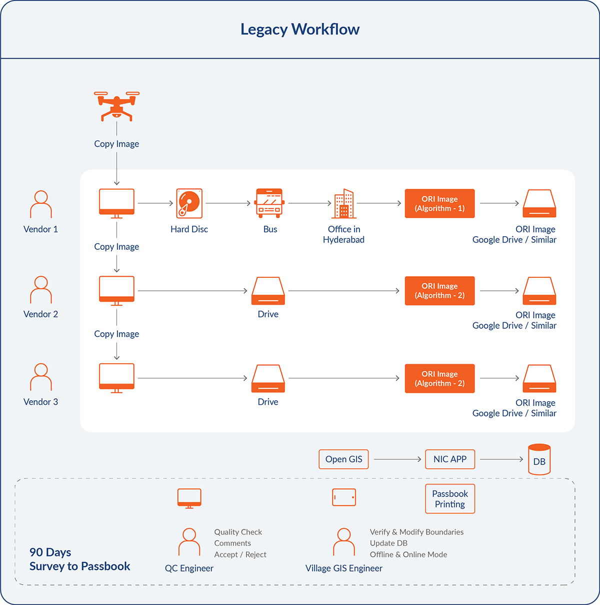
CriticalRiver’s GIS Solution: A Comparison of Past and Present Workflows


Key Features of GIS Application
Total time taken is around 15 to 30 days, starting from survey till passbook generation
System has necessary security features against hacking and defacement.
Features include accessing ORI Data, other images from Image Server
Support adding, updating, editing or deleting GIS land parcel data
CriticalRiver outperforms its competitors with a feature comparison score of 84%, while others stand at 55%.
Blogs
Our thinking on ideas, technology, and trends that create impact
Let’s Start Something New

You can also email us directly at contact@criticalriver.com

